Accurate and timely spatial data helps you plan, run and reconcile your operations and projects.
Our drones can be gathering visual, thermal, survey and vegetation data from above with no impact on your activities below.
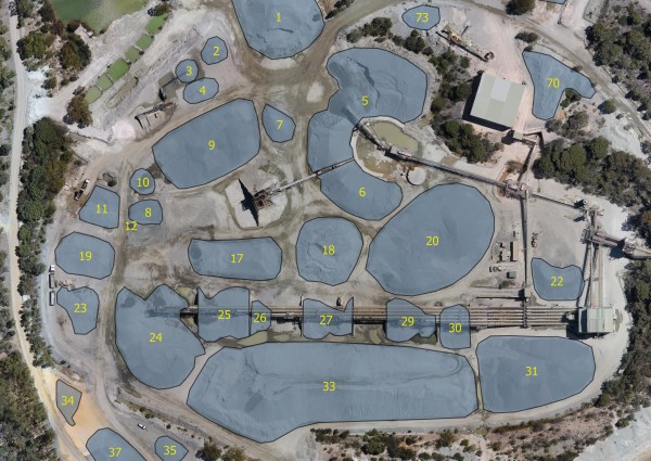
We can measure and report stockpile or landfill volumes, generally with a 24 hour turnaround to enable quicker reporting of your inventories.
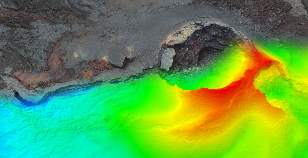
We can map development and construction sites, using visual, vegetation and thermal sensors. This data can be integrated with ground surveys to provide highly detailed DSMs and ortho-rectified imagery.

Drones are particularly useful for gathering data in areas that are hazardous or are environmentally sensitive.
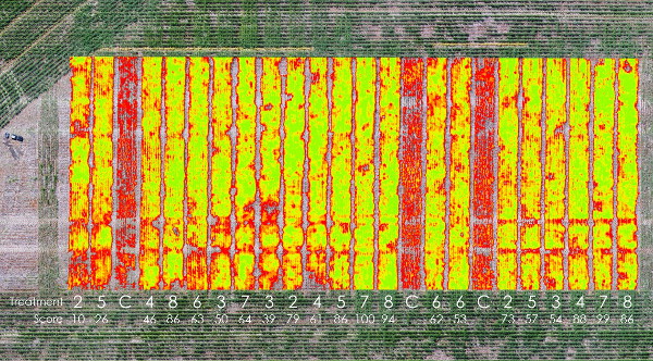
Agriculture research trials can be analysed during the growing season to provide unbiased plant health data for analysis and marketing.
Vineyards, horticulture and forestry plots can be mapped for plant health and plant counts, to optimise inputs and plan selective harvesting.